FEATURE
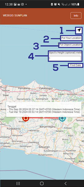
1. Determining User Location using GPS
The feature can be used if the user allows the geolocation API and turns on the device's GPS
2. Manually Determining User Location
Alternative features that users can use by dragging & zooming
3. Manually determine the object's location of photo
determine the location of the object to be photographed on the map by dragging & zooming
4. Inputting Object's Height
Optional feature if the object has height, not a view such as mountains & roads.
5. Search for the right date
Calculate the right date to get to the location